Briançon Area, (Briançonnais) France
The Briançonnais region extends from the Ecrins National Park through the Clarée Valley, the Izoard and Serre Chevalier Valley. It includes the villages of:
Getting to Briançonnais by Air
Fly to the Marseille-Provence Airport or
Turin-Caselle - 133 km
Grenoble Alpes-Isère Airport - 159 km
Lyon Saint-Exupéry - 205 km
Transfer by Bus
You can get a Linkbus from various airports.
Getting to Briançonnais by Train
From Paris:
Daily service by sleeper train, Paris-Austerlitz to Mondauphin-Guillestre
Daily service by TGV, Paris to Valence
Daily service by TGV, Paris to Oulx (Italy)
From Marseille:
Several TER trains daily, Marseille to Briançon, mostly stopping at Mondauphin-Guillestre.
Cross Country Ski Maps of the Briançon Area
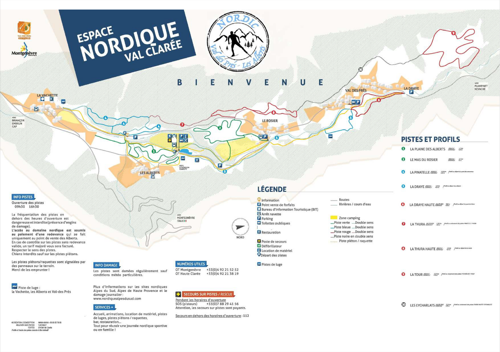

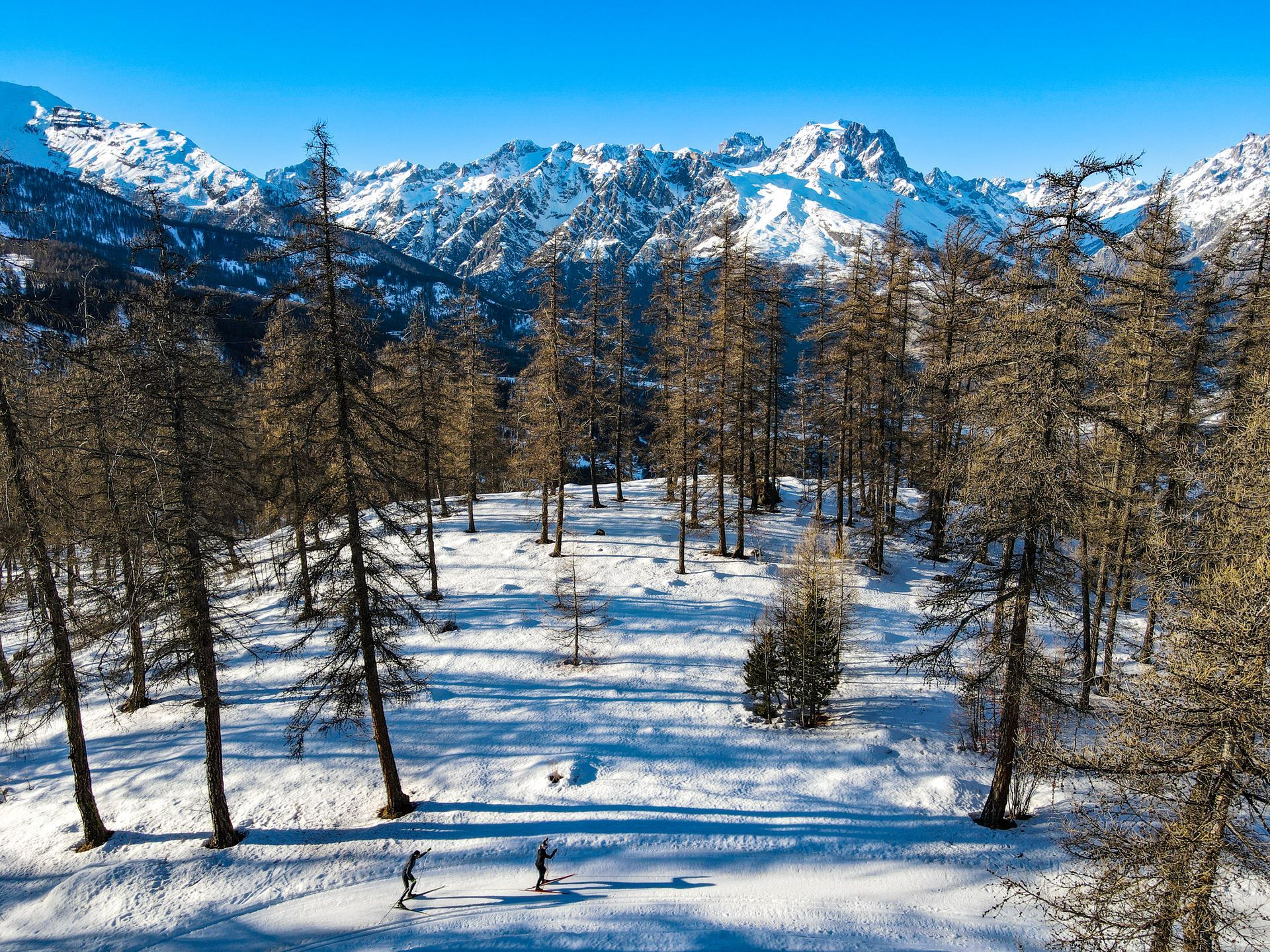
Val des Près - Les Alberts
This area of Le Clarée is a few minutes from Briançon. the Clarée valley. The cross country ski areas of Névache and Val-des-Prés / Les Alberts lie between 1350 m and 1600 m above sea level. On the left hand side there are blue and green tracks for honing techniques and to the right are more demanding trails such as Thura Haute/Basse, Les Echarlats and La Tour.
Puy Saint Vincent
Has 28 km of groomed trails with 9 cross country ski tracks - The Villaret circuit is blue and all the others are red. The resort has an altitude of 2,730 m. Higher altitude routes are La Combe Noire and Tour des Têtes with its view of the Durance valley. You can access the cross country ski slopes from the Prés chair lift for free by presenting a value xc pass at the office.
Check the track status.
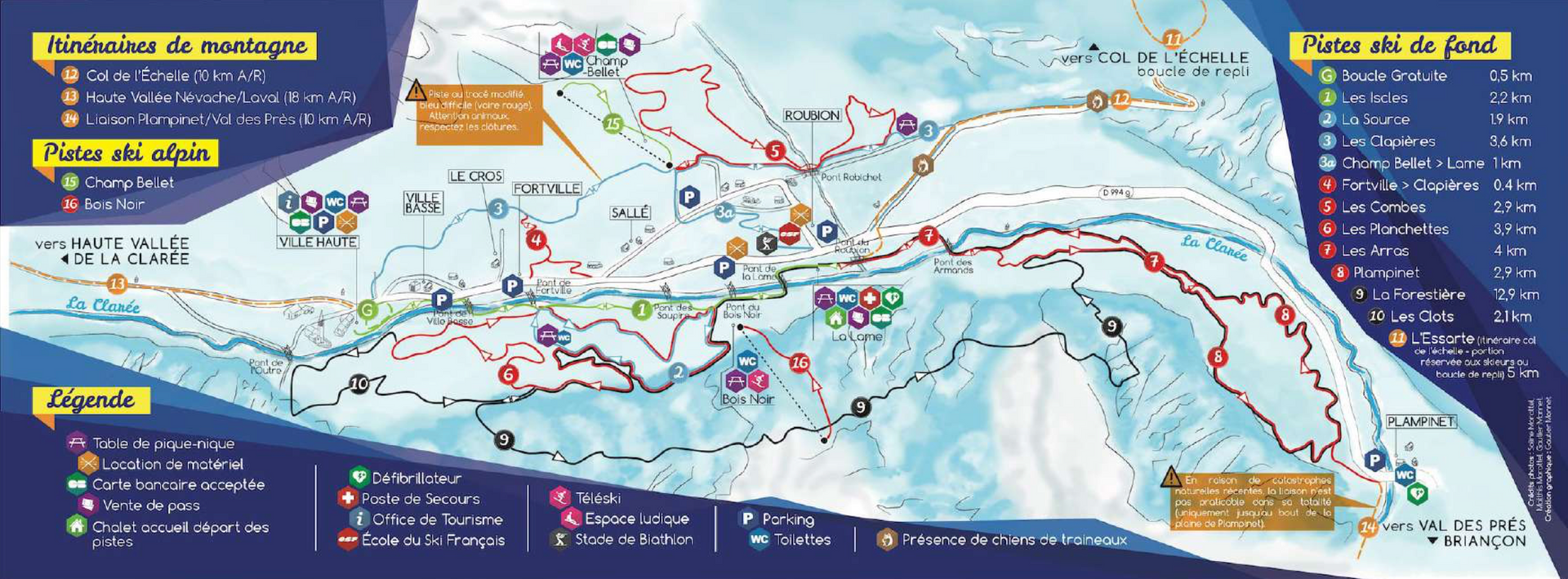
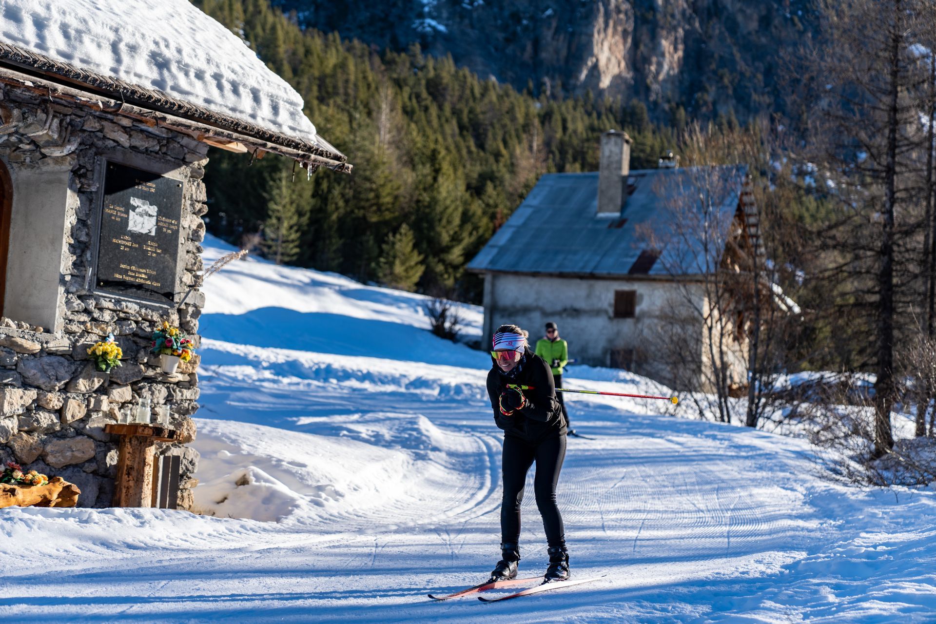
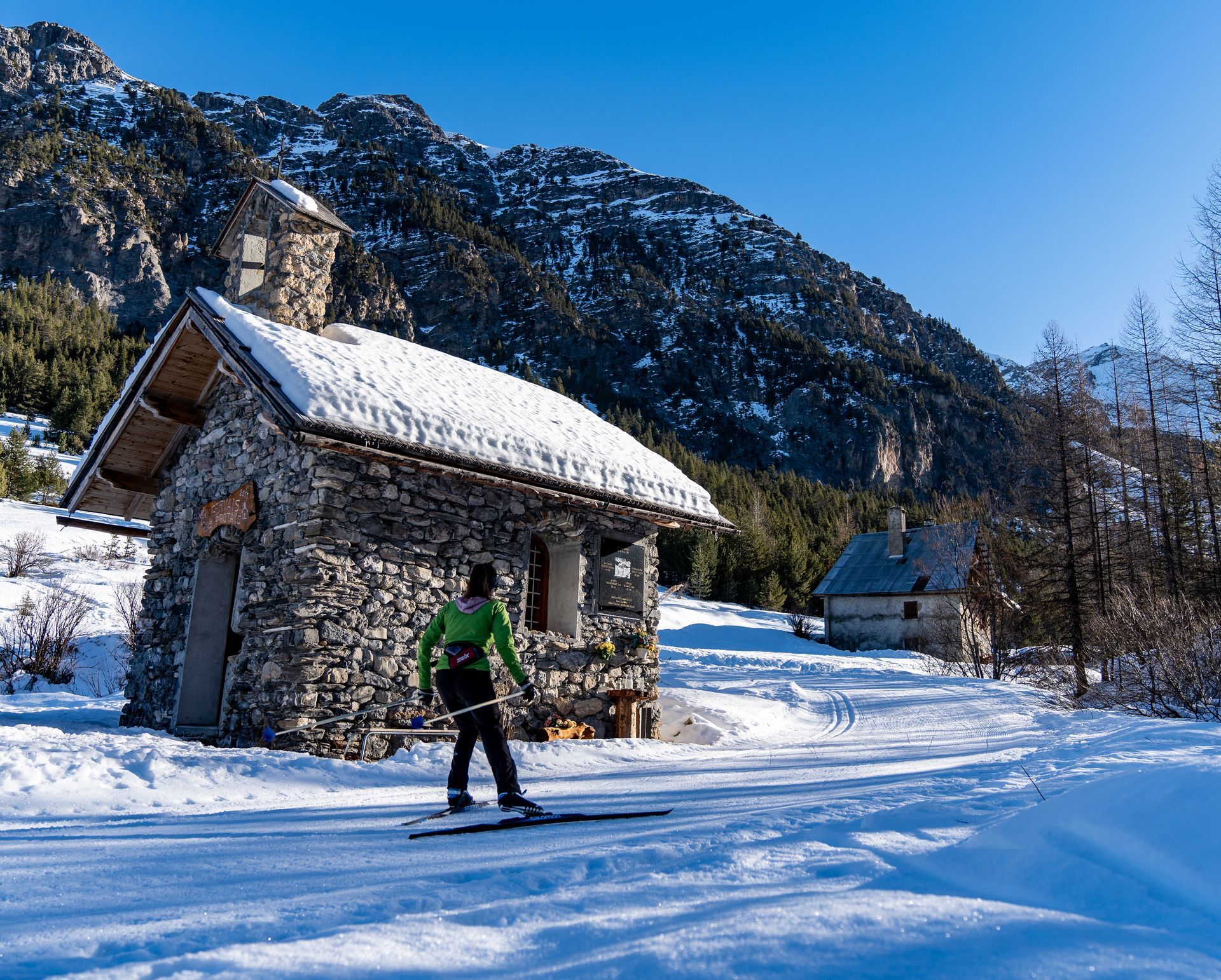
Nevache
Has 13 cross country ski trails. 2 green, 3 blue, 6 red and 2 black. Check the track status.
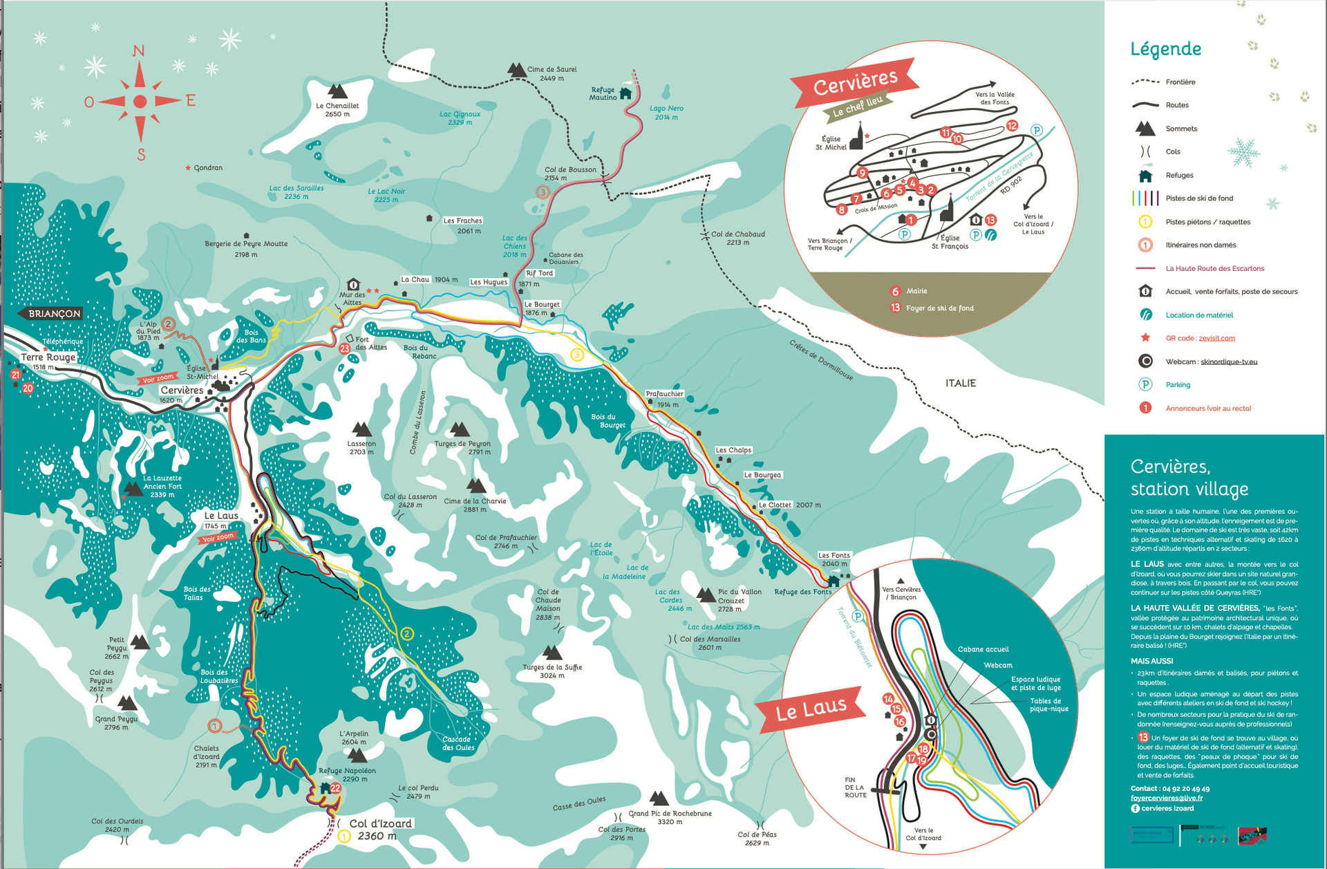
Cervières - Col d'Izoard
The area has 53 km of trails within heights from 1630 to 2360 m cross country ski trails. The area through the pass continues to the tracks in Queyras.
One route that starts from Brunissard, goes up to Col d'Izoard, passing the rocky landscape of Casse déserte which is wild and beautiful. The Col d’Izoard, between Clot la Cîme and Côte-Belle links the Queyras with the Briançon region of the Hautes-Alpes. It's closed from November to May and in winter its southern approaches from Arvieux are transformed into the cross country ski tracks. Check the track status.
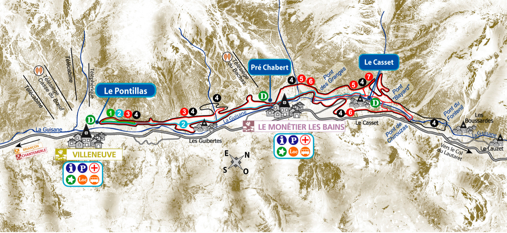

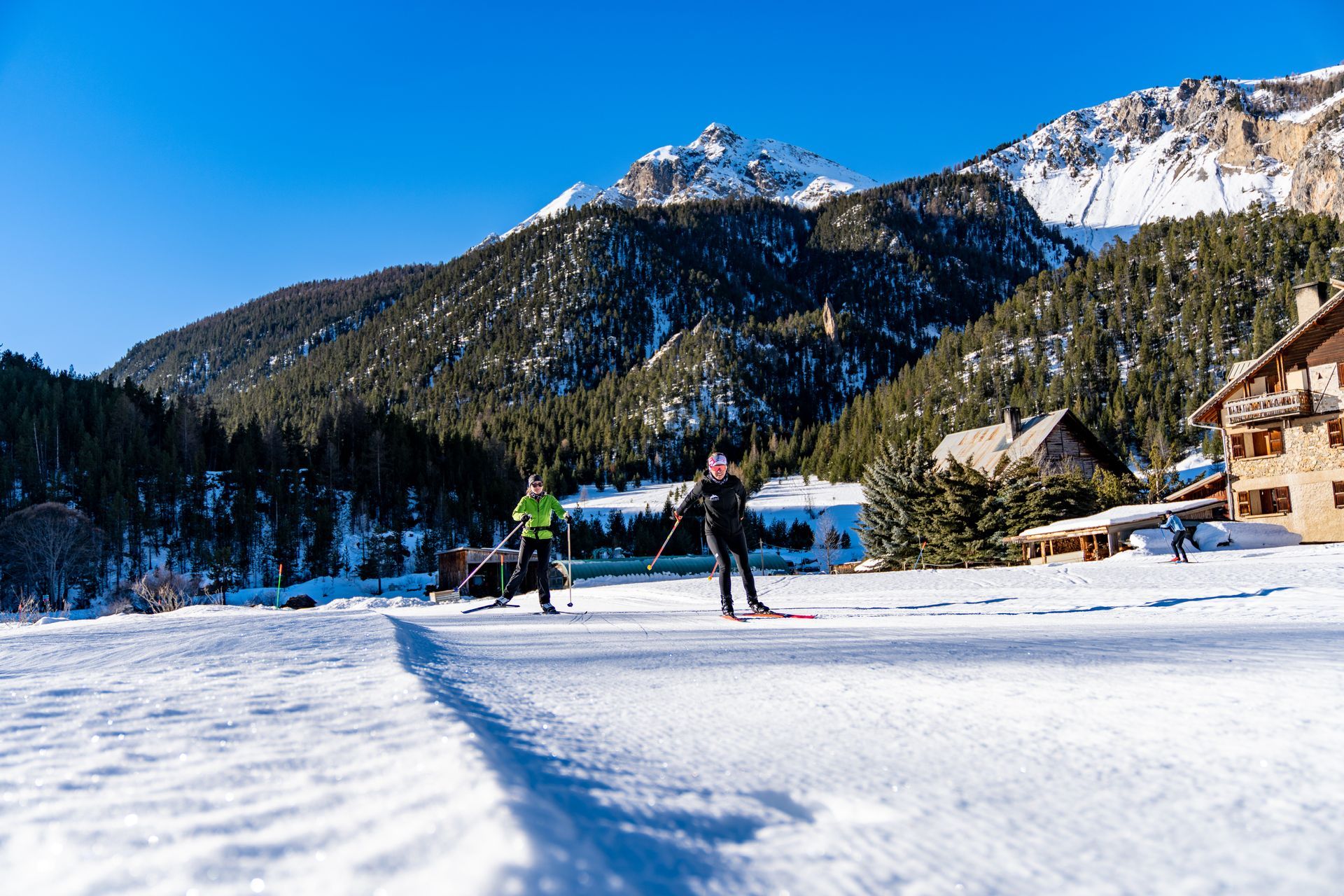
Serre Chevalier
Serre Chevalier's cross country skiing area runs through all the villages of the valley. From Saint Chaffrey to the bottom of the Lautaret pass.
There are 45 kms of tracks, including 10 kms of skate lanes in the valley. Tracks are mostly through the larch woods with mountain scenery that makes it a charming resort. Within a 5 mile radius of Serre Chevalier, there are 282 kms of cross country tracks. The Serre Chevalier region has 13 villages, and the 34 main areas are Brandon, Chantemerle, Villeneuve and Le Monetier Les Bains.
Serre Chevalier Ski Bus
The ski shuttle bus will take you from one end of the valley to the other. It's free with a guest card provided by your hotel or tour operator. They run from Brançon to Le Monetier les Bains and back, which is useful if you want to ski a certain distance and get a bus back, or bus to a place and ski further on.

Villard Saint Pancrace
Pancrace has 36 km of tracks. 3 green, 1 blue and 2 red. Skiing is at 1200 - 1700 metres and they have a 2.5 km track that is lit on Wednesdays in the season.
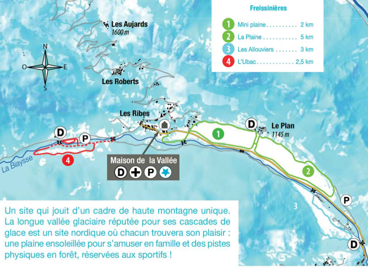
Freissinières
The village has an altitude of 1,180 - 1,780 M and has a mix of forests to the south and rocky slopes to the north. The area is untouched and has the longest hanging valley in the alpine arc and you'll find suspended footbridges across the Biaysse. There are 20.5 km of trails to discovered a mix of woods and inclines.

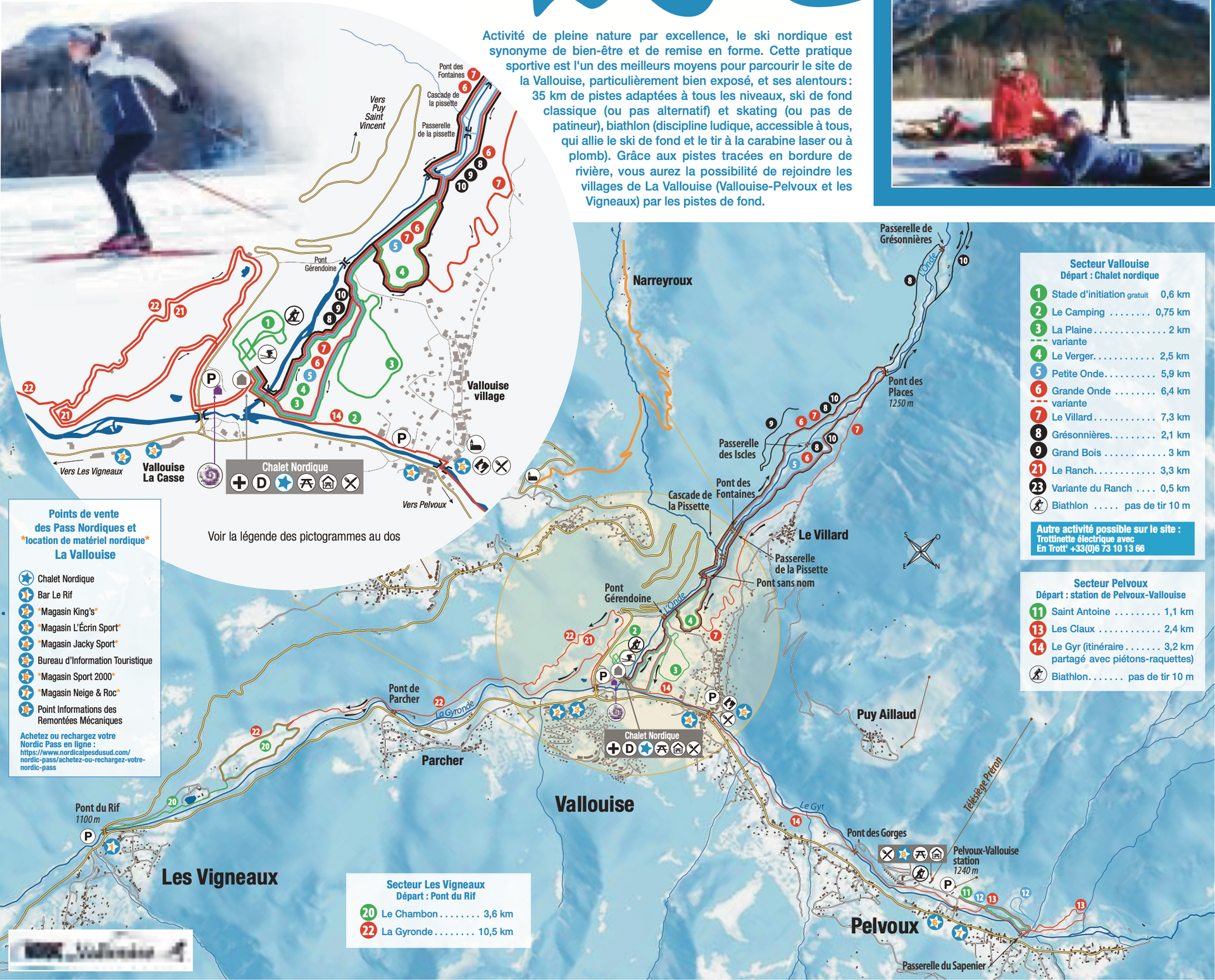
Les Vigneuax - Pelvoux - Vallouise
Vallouise and it's valley provide a ski down the Onde to the Ecrins National Park, Vigneauxand the Gironde Valley, or the Gym which has a gentle ski down to Pelvoux. La Vallouise offers 35 km of tracks and is suited to beginners, whilst Pelvoux has some greens, blues and red to explore, as well as a trails along the river and you can link the three villages together.
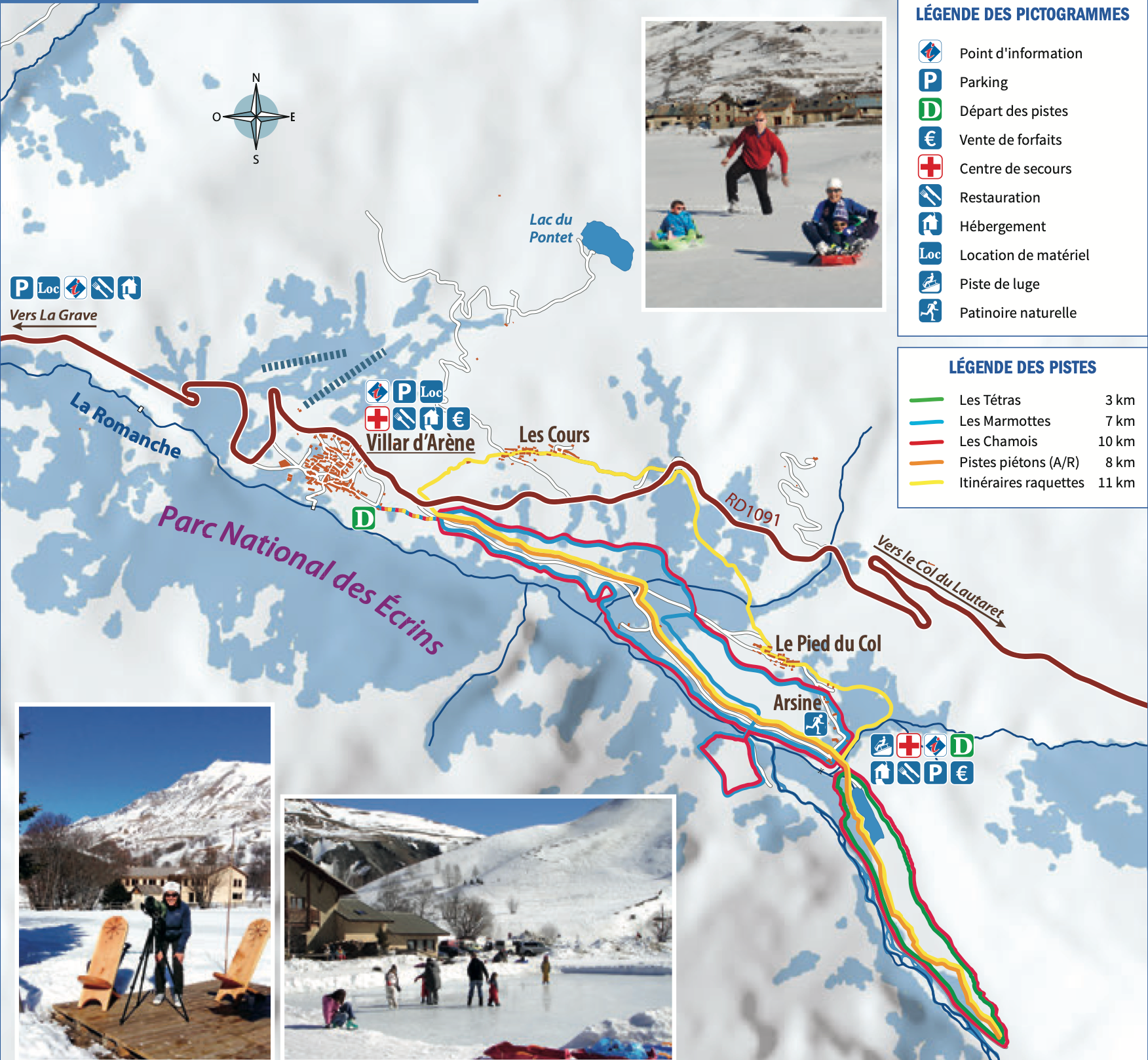
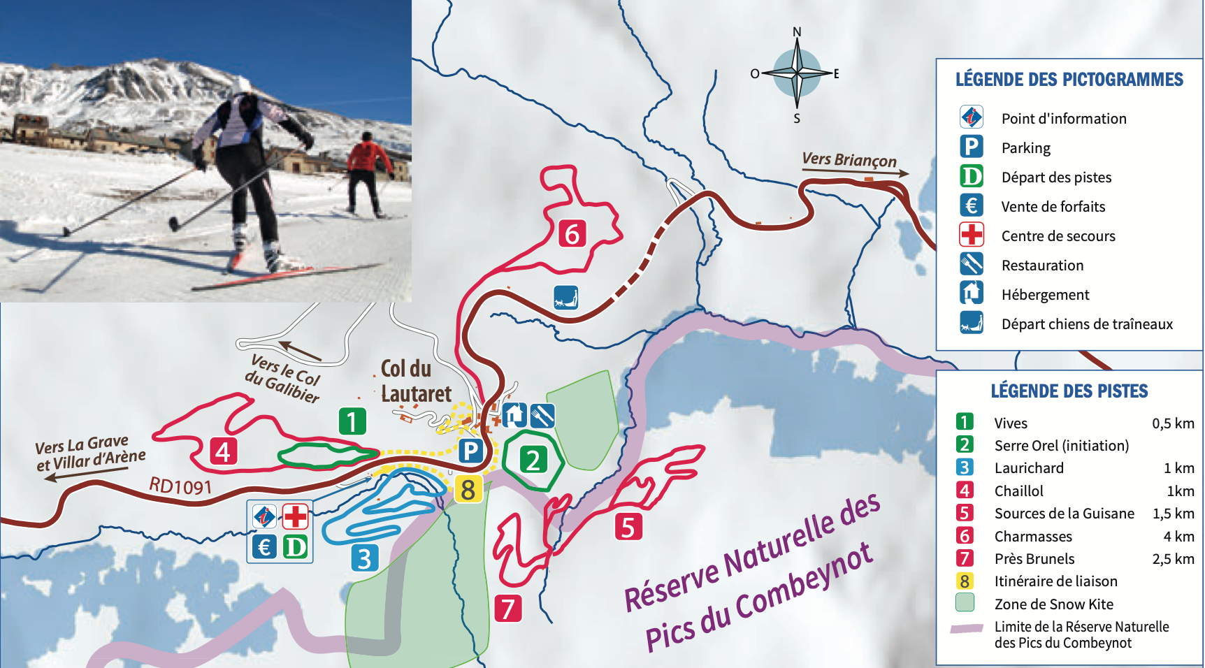
Villar d'Arène/Pays de la Meije
This Nordic area offer cross country ski trails in an unspoilt part of the valley. There is a mixture of forest and river at the foot of the glaciers of the Ecrins National Park. There is a 10 km loop for both disciplines, a 3km green trail, a 7km blue trail and a 10 km red trail. In Pays de la Meije the cross country tracks are at the foot of the Ecrin's Massif with the mountains providing a backdrop. Skate along the Romanche River weaving between rocks and ice sculptures with the chamois on the hillside. The trail passes through the quiet hamlet of Arsine before heading back to Villar d'Arène.
Tour Companies who feature the Briançon area
Tourist Office | Resort Information | Twitter | Facebook