Gallio Campomulo

Gallio Campomulo, Italy

The Centro Fondo Gallio is a 10 minute drive from Asiago and sits at a height of 1500 - 200 metres. It is one of the first Nordic ski centres in Italy and has 150+ km of well maintained tracks, and as such is one of the largest and most important in Europe.

Getting to Gallio Campomulo

We recommend that you base your stay in Asiago so refer to that page for travel information.


Ski bus information/timetable

There are ski buses from the main square in Asiago to Campolongo and Campomulo. The timetables are somewhat complicated and changeable and details and explanations are best obtained from the Tourist Office.

Cross Country Ski Maps of Gallio Campomulo
Gallio cross country ski map
Gallio Competitive cross country ski map
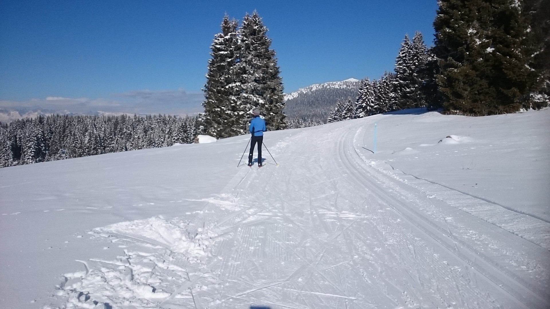
Cross Country Ski Tracks and Routes
The Centro Fondo Gallium has a well-stocked rental facility, which provides skis from the renowned local Slegar factory for both skating and classic skis, Salomon brand shoes and bindings, Fizan poles. There is also a wax room and staff can provide advice.

The Centro Fondo Gallio is an ideal place for cross-country skiing, with its unspoilt nature such of the Asiago plateau, and endless kilometres of well groomed løipe.

The Campomulo Refuge has a bar and restaurant, large solarium, relaxation sauna , toilet, showers, changing rooms and equipment rental, and parking for 1000 spaces.

The refuge is equipped with double rooms equipped with all services (television, telephone, music).
Gallio Cross Country Ski Routes
  • Campomulo - Easy - 5 km

    60 m of ascent.

    The Campomulo slope is the easiest, because it was designed specifically for beginners. It is on the flat with slight ups and downs and winds along the Campomulo valley, sometimes immersing itself in the woods and crossing large clearings for other stretches.

  • Moline - Medium - 20 km

    210 m of ascent.

    The Moline track is the main track of the Centro Fondo Gallium. It is a pleasant and varied route, of medium difficulty and suitable for everyone. It alternates between uphill and flat and downhill sections.


    It starts from the base refuge "Campomulo" and, after going through a few hairpin bends uphill, you reach the Sella di Campomuletto at 1600 m.


    From here you proceed along a flat path and, near Malga Fiara, you meet  the left the track coming from Prà Campofilone.  Continue to the right up to Malga Mandriele at an altitude of 1550 m and pass it to leave by the track coming from the vast basin of Marcesina on your right.


    At this point you go down, a stretch that leads to the head of the Val Scura. Leaving the fork for Malga Fossetta on the right, you start to climb again and after a few hairpin bends you arrive at the Selletta at an altitude of 1641 m.


    Here then you go down taking the first two crossroads to the left. You then arrive at Prà Campofilone and from here continue east to the Selletta, from which you descend to Malga Fiara at an altitude of 1600 m above sea level. At the crossroads, turn right and, after going through a slight slope, you arrive, slightly uphill, in Campomuletto and then gently descend to the Campomulo Refuge.


    The Pista Moline also includes the VARIANTE LOZZE, which extends the path by about 2 km, passing the Lozze square at 1805 m.

  • Molina Variant - Difficult

    210 m of ascent.

    This variant allows you to reach Porta Molina directly from the red Moline slope. Take the crossroads after the Buso del Diavolo keeping the right.

  • Ortigara - Very Difficult - 29.5 km

    570 m of ascent.

    The Ortigara slope is undoubtedly the most beautiful but also the most difficult slope of the Centro Fondo Gallio. The route passes through lovely landscapes and places of particular historical interest.


    Start from the Campomulo refuge. After a first slightly uphill stretch, you arrive at the Sella at an altitude of 1624 m, and from here to Malga Fiaretta or Malga dei Sogni and then to a large clearing which is the setting for the famous peaks of the First World War.


    After a short but rather steep ascent and a long descent, you enter the forest of Monte Fiara and, with a very varied route to Malga Boscosecco. Continue going up to a crossroads at which you have to take left (turning right, instead, you rejoin the Pista Moline near Prà Campofilone) and follow a flat stretch that crosses the  Mitterwald forest until you reach, after about 2 km, the Fontanello di Boscosecco.


    From here you go up and take the Busa di Terre More and the Busa del Pettine until you reach the crossroads of Monte Forno. Here you have to take the left track and go up to the crossroads which is at the head of Val Galmararaat 1937 m, from which the view extends to embrace a glorious panorama. At the crossroads, turn right and after 1 km of ascent you reach the crossroads Italy at 1987m above sea level from which you head towards Mount Ortigara along Cima 11 and Cima 12.


    After about 7 km you reach the summit of Ortigara, at an altitude of 2106 m, where the memorial stones to the fallen of the Great War are set. From here you descend towards Malga Moline for about 3 km, along a descent that is quite difficult and impossible for the groomers to maintain.


    From Malga Moline you return to the base refuge "Campomulo" along the Moline slope. When it isn't possible to go this way however, it is better to return the way you came and, at the crossroads of Monte Forno, take the track to Malga Moline, as described in the explanation of the path of the Valsugana track.

  • Ortigara Variant

     570 m of ascent.

    In spring, the Ortigara track can be skiied in the opposite direction: from Malga Moline, by going up to Cima Ortigar along the shortest route in a northerly direction towards Piazzale del Lozze and the yellow Valsugana track, which is right at the crossroads.


    Instead, climb to the left along the slope (not mechanically maintaned) along a cart track, which leads to the refuge and the Church of Lozze. From here you climb to a saddle and then head north-west to Malga Ortigaraat an altitude of 1937 m. From the hut, continue to the basin and reach the foot of the final climb, which, despite appearances, is not particularly demanding, facing the zigzag valleys.


    From the summit of Monte Ortigara you return to the starting point by going backwards on the Ortigara slope described above.

  • Pozze Variant - Very Difficult - 5.5 km

    Recommended only for expert skiers, on this variant youwill enjoy the experience of facing an exceptional and varied route with continuous ups and downs, in a majestic natural setting.


    The  link  connects Monte Forno to Malga Moline passing through Malga Pozze and Malga Campo Luzzo.


    The route can be travelled in both directions, i.e. from Malga Moline towards the Campomulo Base Refuge or from this to Malga Moline, along the Ortigara track to the crossroads of Monte Forno to which you turn right.


    Many choose to travel this variant from Malga Moline to reach Ortigara in a more direct way.

  • Valsugana - Difficult - 29.5 km

    370 m of ascent.

    The Pista Valsugana is so named because it allows you to reach the north end of the Asiago plateau, where it overlooks the underlying Valsugana.


    The first stretch is the same as the Ortigara route, from which it branches off at the crossroads of Monte Forno. From here, taking the track to the right, you go along a long slope and reach the saddle at an altitude of 1601 m.


    At this point, continue to the crossroads where the main Moline track, marked in red, passes. Turn left towards Malga Moline along a varied route in which undulates with small descents.


    About 200 meters from the hut, keep left in the direction of Piazzale del Lozze, cross it and go up north until you reach the Pianoro di Prà della Portain view of Monte Caldiera . After about 1.5 km you reach Porta Molina, at an altitude of 2000 m, overlooking the Valsugana, the Dolomites and the villages below (Strigno, Borgo Valsugana, etc.).


    The return journey follows a short section of the track and then turns left. An easy descent, with some short more inclined stretches, leads back to Malga Moline, which is passed on the left. Going down, after a couple of hairpin bends, you reach the plateau of the Buso del Diavolo . From here, after going up and down and round a few more turns and a couple of hairpin bends, you then arrive at the Fossetta crossroads, which you leave on the left, continuing for a while to go down.


    Once you get to the rocks of Poggiolo Cattagno, you start the 8 km long plain which leads to Malga Mandriele, then to Malga Fiara and finally to Campomuletto and from here,  begin the descent to the Campomulo base refuge.


  • Fossetta - Difficult - 26 km

    180m of ascent.

    The first part of Pista Fossetta coincides with that of Pista Moline, from which it branches off at the crossroads for Fossetta where  you take to the right. This begins a slight but continuous climb which after about 2 km leads to Malga Fossetta, at an altitude of 1666 m, and a little higher up the Chiesetta della Fossetta .


    From here you  proceed north on varied terrain through the woods of Campo Casara to arrive at a steep climb with a drop of about 70 m to be done in steps, at the end of which the track continues on a mule track that climbs in a tortuous way until it laps Monte Isidoro - Porta Molina in view of the Valsugana.


    The return route is the same as described for the Valsugana slope. From the hut, take a stretch of the "red" Moline track to Prà Campofilone and take the right as indicated by the yellow signs. Descend to Malga Bosco Secco , ascend to Casara Fiaretta , and then arrive at the Sella at 1624 m. above sea level. From here, after 1 km of descent and a few hairpin bends, you reach the Campomulo base refuge.

  • Marcesina - Very difficult - 26 km

    180 m of ascent.

    The Piste Marcesina starts from the Campomulo Refuge and follows the road connecting to the Marcesina plain. The route heads slightly uphill to the north up to a crossroads at an altitude of 1564 m to which you must take to the right and follow the track that cuts the slope  and leads to Selletta at 1601 meters above sea level.


    From here a long downhill stretch of 5 km, totally immersed in the woods, leads to the Piana di Marcesina. This is undoubtedly the longest and most fun descent you can do in this area.


    At first part is rather sloping and has some curves and hairpin bends, then the descent becomes gentler up to the crossroads of Campo Cavallo at an altitude of 1434 m, on the southern edge of the Conca di Marcesina. From this point continue on flat terrain, up to the Marcesina Refuge and, higher up, to the Homonymous Hotel.


    On the way back, take a 3 km long hairpin climb, immersed in the woods, which leads to Malga Mandriele. Here, at the crossroads, continue to the left and follow the slight slope to Campomuletto. Then proceed downhill with hairpin bends to Campomulo.

  • Competitive Track - Very Difficult - 10 km

    This is a track reserved for competitions and athletes' training. It was built as an ad hoc for competitive events, including high level ones, national, international and World Cup.


    It is possible, using the various connections, to take part in competitive events on all the distances foreseen by the FISI and FIS regulations.

  • Meimerle Agnostic Track - Very difficult - 7.5 km

    Route shown on the map above.


    The "Meimerle" competitive track was designed for high level cross-country races and for the training of athletes, but it is accessible to all those who wish to experience the thrill of facing a champion track!


    It should be noted that the track presents a high degree of difficulty along its route, long climbs alternate with amusing ups and downs and breathtaking descents with sudden and very difficult curves. It is therefore advisable to follow it only if you are an expert -  access to beginners with the basic technique of descent and snow plow with snow plow curves is not prohibited.


    On this track it is possible, using the various connections, to take part in competitive events on all the distances foreseen by the FISI and FIS regulations.


    The start and finish of the Meimerle track is located right in the center of the Stadio del Fondo, near the Campomulo base refuge. The route runs, for the most part, in the west section of the access road to the Centro Fondo Gallio.

  • Tagaloch Competitive Track - Very Difficult - 5 km

    Route shown on the map above.


    The "Tagaloch" competitive track was specially built for women 's training and cross-country races at a high level, keeping in mind all the technical characteristics of the other best competitive slopes in the world.


    As for the "Meimerle" competitive track, the "Tagaloch" track also starts and finishes in the center of the Fondo Stadium, in the immediate vicinity of the Campomulo Refuge.


    The track is very technical and runs east of the access road to the Centro Fondo Gallio with steep and long climbs, vast flat stretches and difficult descents with tight curves.

Cafes on Cross Country Routes


The Campomulo Refuge is at the start/finish of the tracks and has a bar and restaurant.


Adriana Malga Moline Refuge is to the north, about 9 km from the Campomulo base refuge, following the shorter track, in a sunny position at 1740 m, just below Monte Ortigara. It is a real alpine refuge, accessible only by skis or on foot or snow mobile. It has a large solarium, bar, restaurant with a grill and spit, showers, dressing room, 25 beds in a bunk bedded dormitory.

Where to Stay


The best place to stay would be in Asiago .

Tour Companies who Feature Campomulo
We don't currently know of any operators who feature this area.
Share by: