Beitostølen, Norway
Beitostølen (pronounced bait-oh-stir-len) lies on the edge of the beautiful Jotunheimen National Park and offers 320 km of groomed cross-country trails in the forest and mountains. It is a compact resort, easy to get around, and situated around the base of a downhill ski area. The resort facilities are all within easy walking distance and for a small village, there is a surprising number of restaurants, bars and shops to choose from, plus several supermarkets and bakery, all housed in attractive wooden cabins.

Getting to Beitostølen by Air
Oslo Gardermoen is the easiest airport to fly to and is about a 3 to 4 hour bus journey away. British Airways flights to Oslo on Sundays.
Fagernes is the nearest airport 45 minutes away, but there are limited flights there.
Transfer from Oslo by Bus
Vy.no have recently taken over travel on this route from Nor-way.no. There are train and bus options from Oslo bus terminal, but those from the airport only departs on Thursday, Friday and Sunday.
Bus transfer from Fagernes Airport Leirin to Beitostølen is only 45 minutes.
Taxi Services
The number of a local taxi service is
+47 613 406 00
and useful to keep handy in case of need.
Ski bus information/timetable

There is a free small ski minibus that runs between Beitostølen and the downhill resort at Raudalen. You can use this to start the routes further to the west, or to bus/ski in either direction from Beitostølen if you don’t want to ski both ways.
The bus picks up from the lay-by next to Huset Steak and Bones restaurant and the cafe at the foot of the Raudalen downhill piste. You may even find that if you are the only ones on the bus, they will drop you to your hotel if it is reasonably central.
This service only runs in peak season.
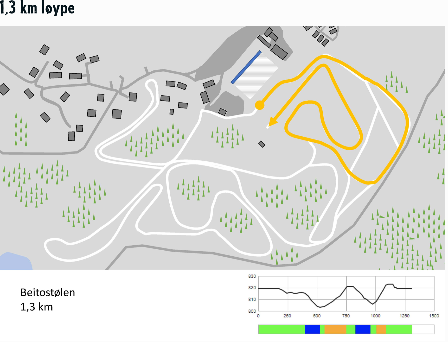
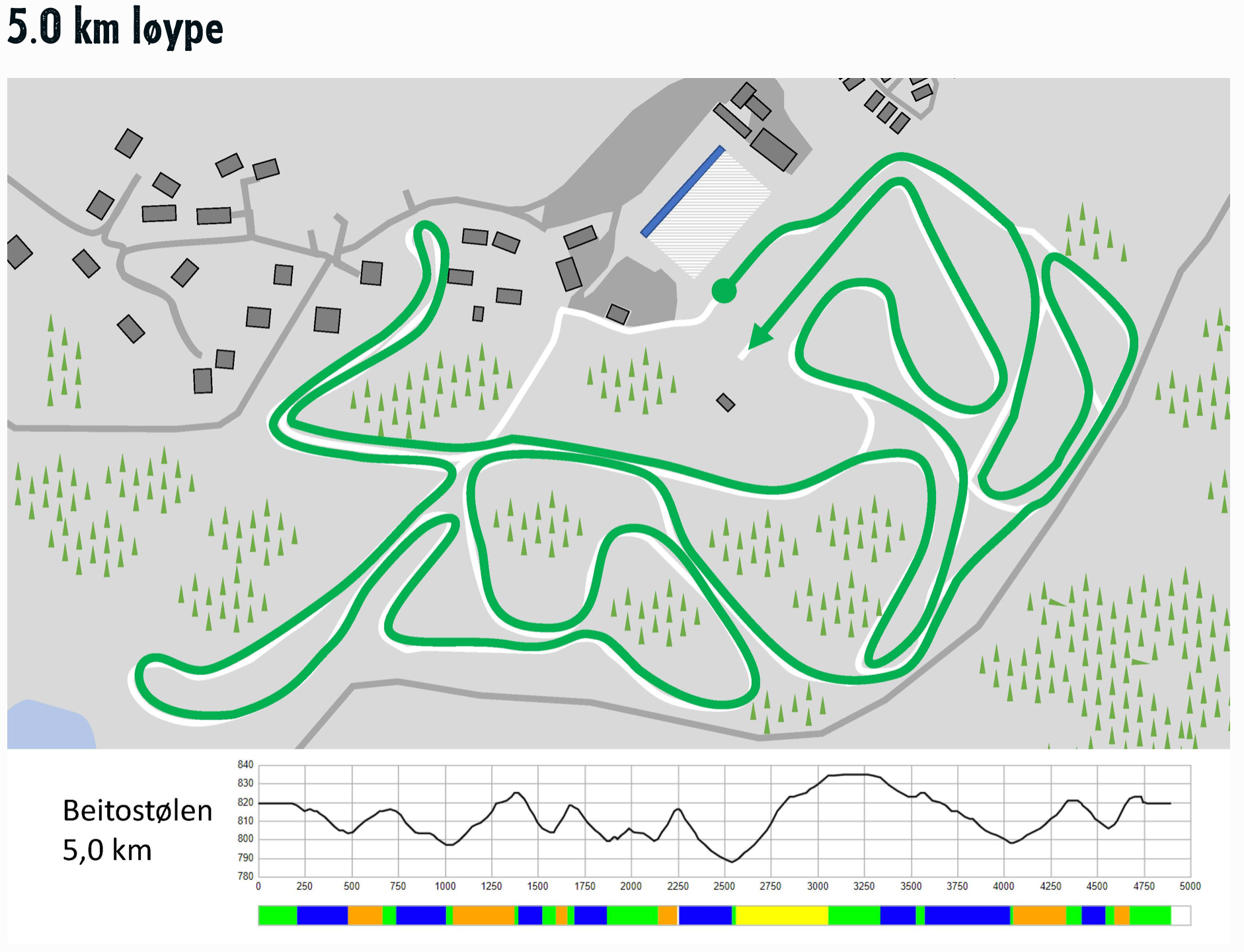
Cross country ski map of Beitostølen and the resort
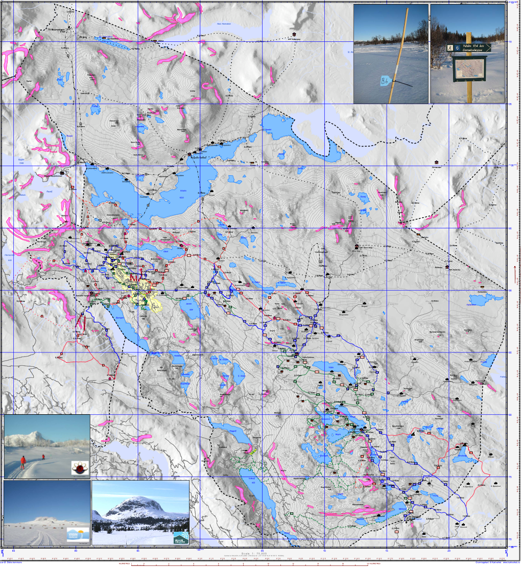
Beitostølen xc ski map
Button
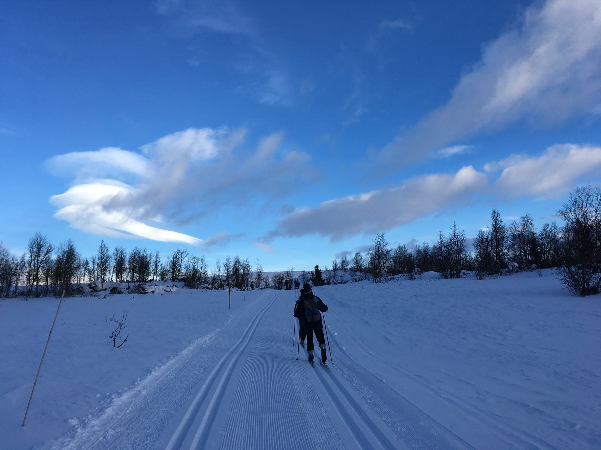
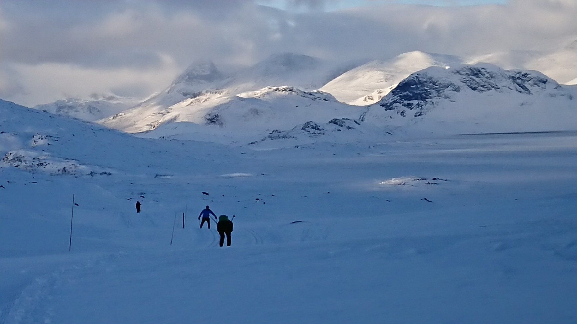
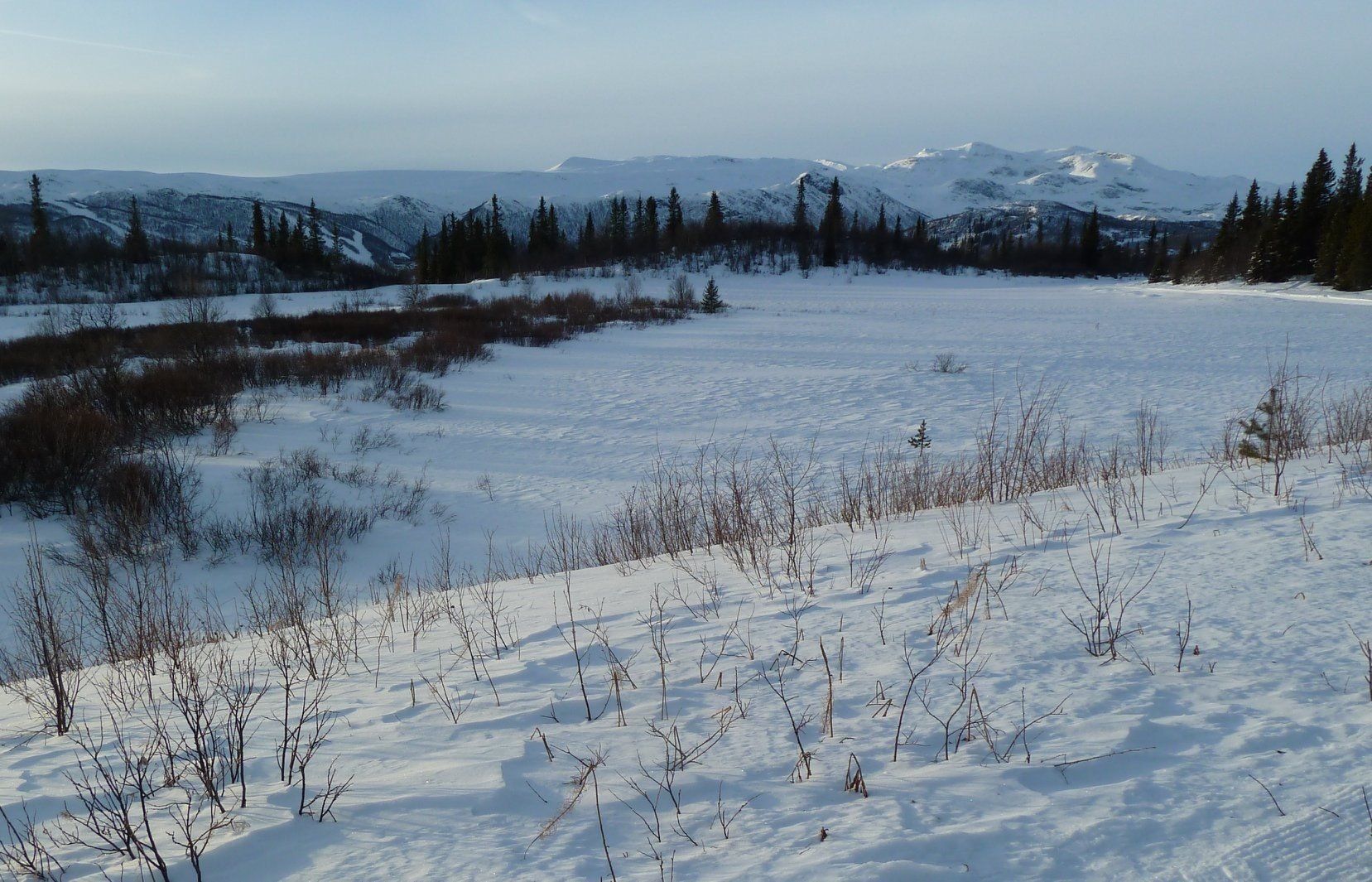
Cross Country Ski Tracks and Routes
The best way to plan your route is to use the interactive map of ski tracks and information on when the ski tracks were last groomed. This map can be accessed from a phone and is useful on the trail, and also gives the route profile and length. This information is available for the whole of Norway so can be used in other resorts. N.B. Skisporet seems to be unresponsive at present 13/10/25. We will check back regularly to see if it is available this season.
The local association is a collaboration bewteen industry, cabin owners, residents and landowners who produce
a report on how they are preparing the tracks for the season.
Don’t be fooled by the Green and blue labelled trails. I found nothing flat except some tracks around the stadium, and some of the green’s are quite deceptive and not that easy for beginners! Head towards the ski stadium if you want to be on the flat for a bit of technique training, or challenge yourself to the World Cup course there.
Beitostølen Cross Country Ski Routes
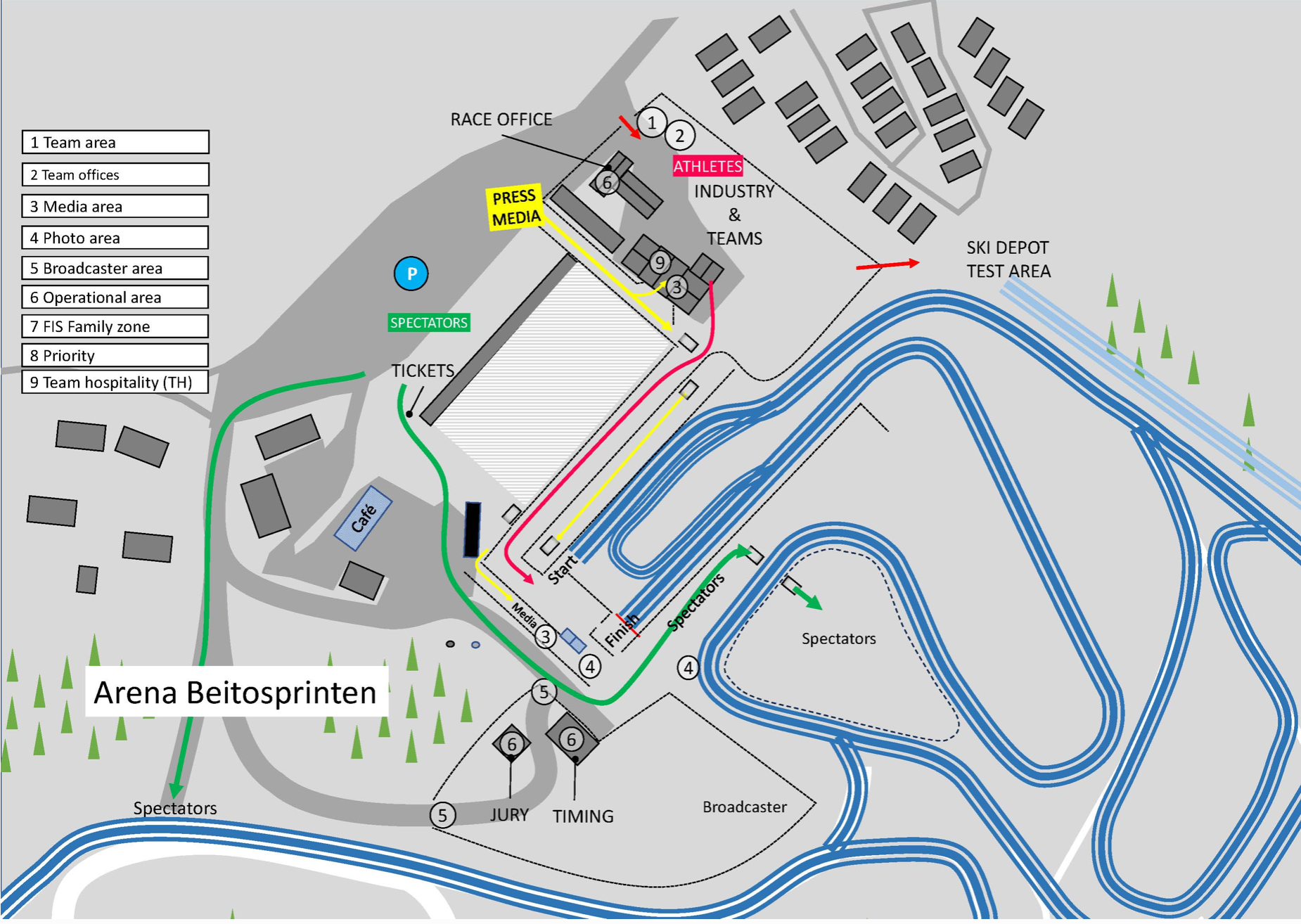
The Stadium have their own website, with detailed information the stadium at Beitostølen. There are 12.5 kms of world approved tracks and 7.5 kms of artificial snow are laid down for an early season start is a lit trail of 5 kms. In summer there is a roller ski course suitable for beginners and intermediates. And the biathlon range has 30 targets for all levels.
There is a charge for use of the stadium and you can see the various layouts below.


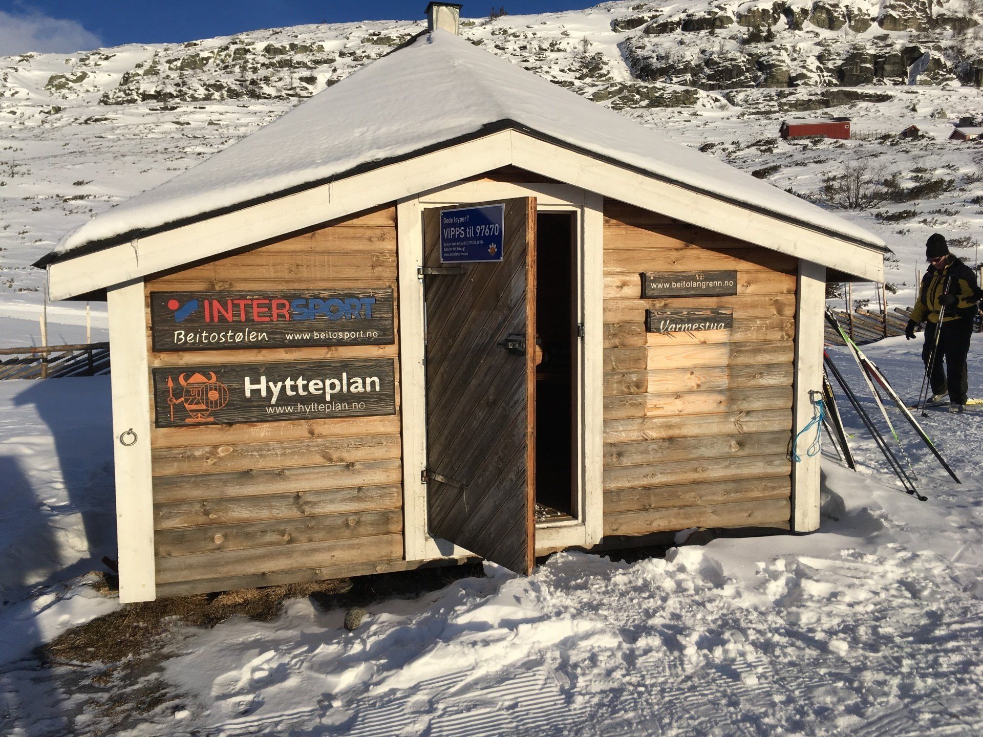
Cafes on Cross Country Routes
The nearest you get to a café on the trail in Norway are small cabins to warm yourself along the route. They are quite difficult to spot sometimes, but are marked on the trail map as blue huts. Around Beitostølen several cabins are open daily during the winter weeks 7 – 8 – 9 and Easter. In some of the small cabins they serve food and beverages during high season periods. But usually be prepared to bring a packed lunch and thermos flask for your refreshment stop. If you're lucky there will be a log burner to warm up by.
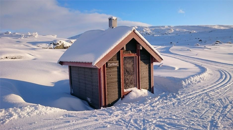
Fjellbu from the left hand side
On Red 1 near the left hand end of Olevatnet lake.
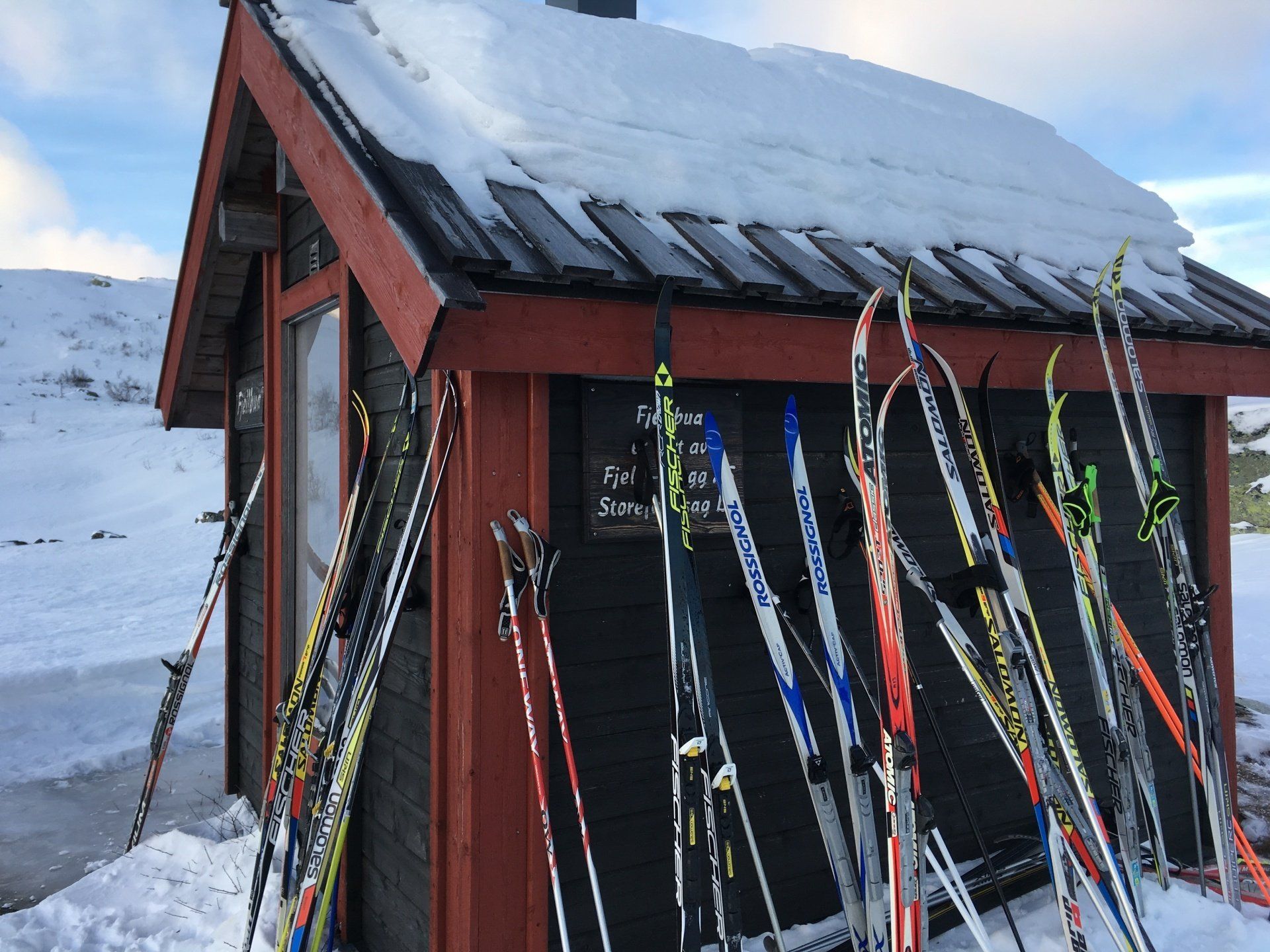
Fjellbu from the right - fully occupied!
On Red 1 near the left hand end of Olevatnet lake.
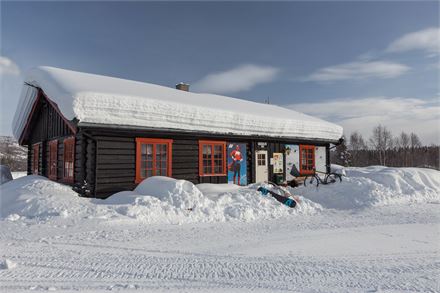
Olebu
On Red 1 at the right hand side of Olevatnet lake.

Looking back at Olebu
On Red 1 at the right hand side of Olevatnet lake.


Where to Stay
There is a good choice of accommodation of all types within the village. Popular hotels are the Radisson Blu and the Bergo, and Apartments are also at the Bergo. There is a selection of tour companies who service this resort which are detailed in the section below.
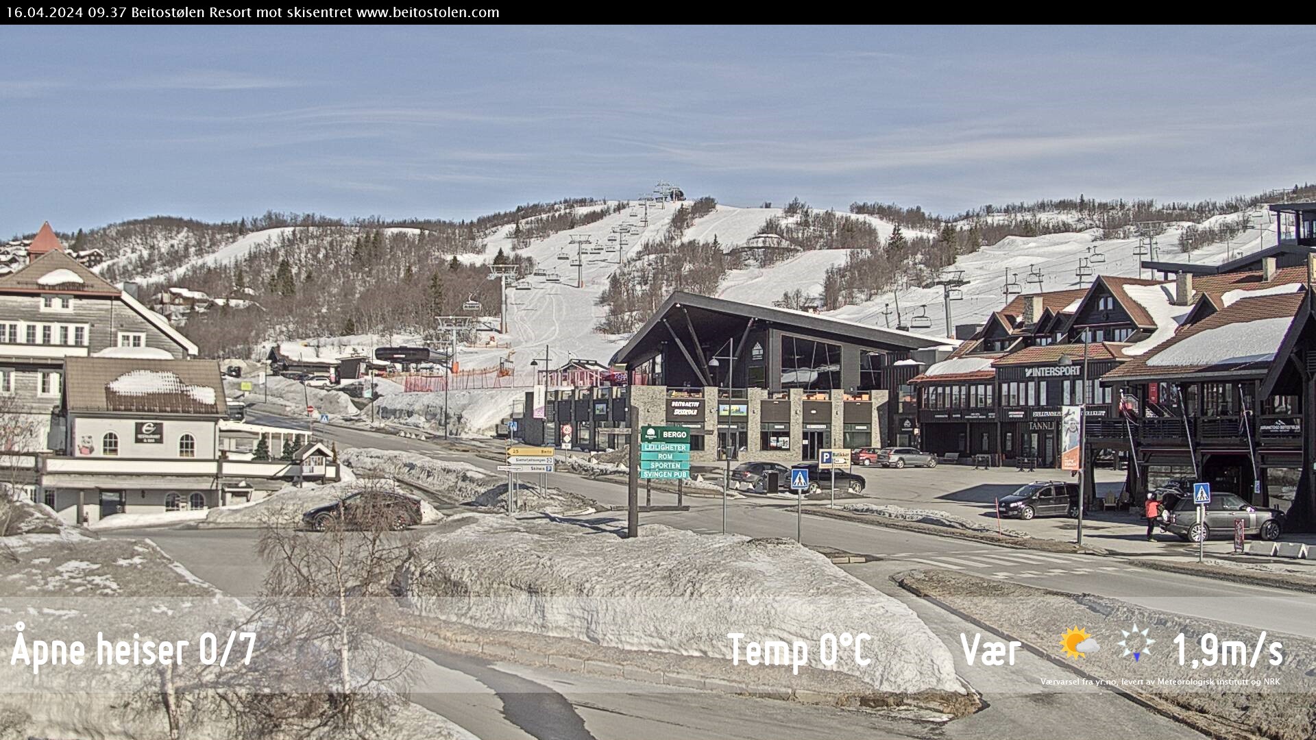
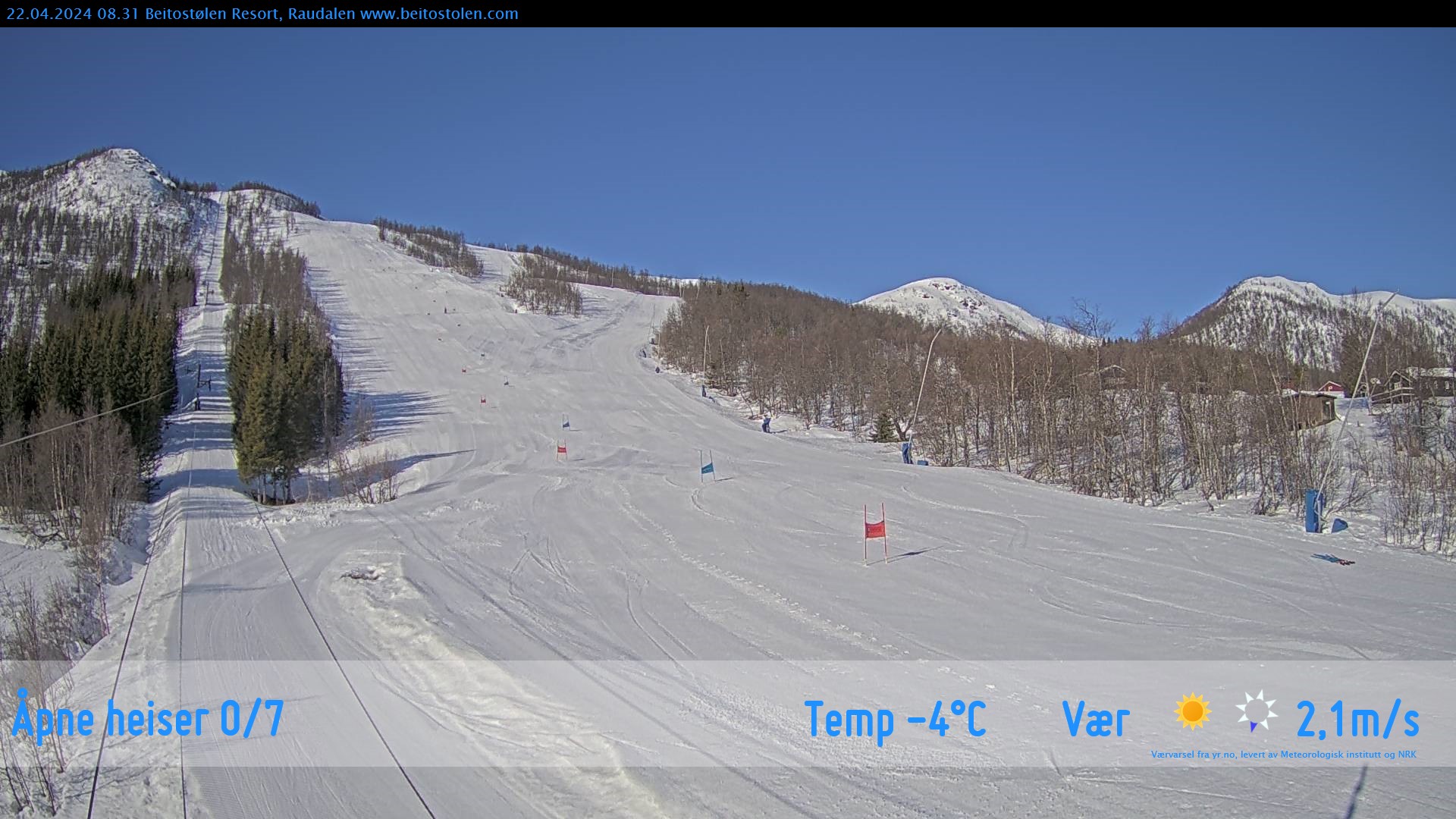
Webcams

Bars and Restaurants
There is a good choice of places to eat in Beitostølen if you don't have half board in your hotel, but be aware that prices in Norway are quite high, especially alcohol. Popular one are - Peppes Pizza (burgers and pizzas) and Chen's Beijing House (Chinese). I think they both also do takeaways and they are opposite the Bergo hotel.
Popular bars - The Svingen Pub.
Cross Country Ski Rental/Retailers
Mikkel at Beitostølen ski rental is one of the best ski rentals for cross country skiing in Beitostølen. It is also conveniently located for the Bergo and Radisson Blu hotels next to Intersport. Here are the xc rental prices for 2023.
Supermarket
There are 3 supermarkets in town. One opposite the Bergo hotel which is the largest, another down past the Bergo near the Tourist office on the right hand side of the road, and the Kwik supermarket at the end of the town, just next to where the Red 1 starts.
Cross Country Ski Races
The Valdres March is a popular ski race (classic style) from Beitostølen to Danebu, a distance of 65 km. You can also choose a shorter distance. The race was first organized in 2001. Information can be found here although it appears it has not been run since 2020 due to lack of organisers.
Tour companies who feature Beitostølen
Beitostølen Tourist Office | Resort Information | Twitter/X | Facebook | Instagram
This is the main Beitostølen tourist information website. You will find the tourist office a little further down from the Bergo Hotel going towards the bottom of the town.
Beitostølen on Twitter/X is @Beitostolen
The official Instagram account is https://www.instagram.com/beitostolenresort/