Jura, France
The Jura Mountains are a 30-minute drive from Geneva, and straddle the border of France and Switzerland. They offer a network of around 3,000 kilometres of groomed cross-country ski trails centred around villages. There is also an 80 kilometre trail that runs through the Massif du Jura called the Grande Traversée du Jura, which parallels the arc of the crescent-shaped mountain range and is groomed for both classic and skating techniques. It is a linear route that can be skied as a tour for a week or so transporting baggage on ahead, or arranging transport back to a base each day. Additional information provided by Alan Thornton of LRNSC.
Getting to the Jura by Air
The nearest airport is Geneva.
Getting to the Jura by car
It is about a 12 hour drive by car and is the best way of getting around once you are there.
Ski bus information/timetable
Cross Country Ski Tracks and Routes
- long relatively easy flat valley tracks
- more challenging hillier terrain along the French/Swiss border in tracks at - La Vattay (Col de la Faucille 1250m – 1350m) and the Forêt du Massacre 1150m – 1300m between Les Rousses and Lamoura
- other areas to try are Lamoura, Les Rousses, Bellefontaine, Les Fourgs, Swiss Balcon du Jura.
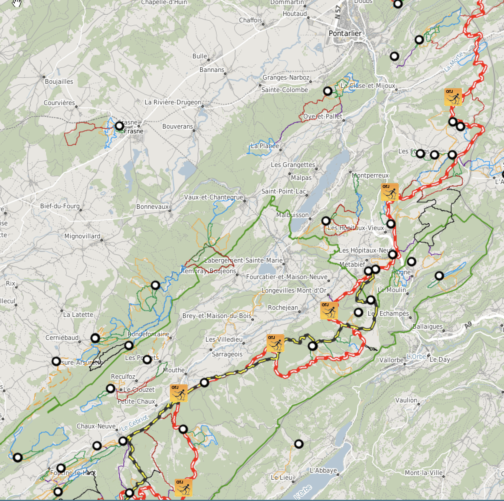
Grande Traversée Cross Country Ski Routes
Where to Stay in the Jura
- Les Rousses
- Lamoura
- Col de la Faucillle
- Foncine le Haut
- Les Molunes
- Les Fourgs
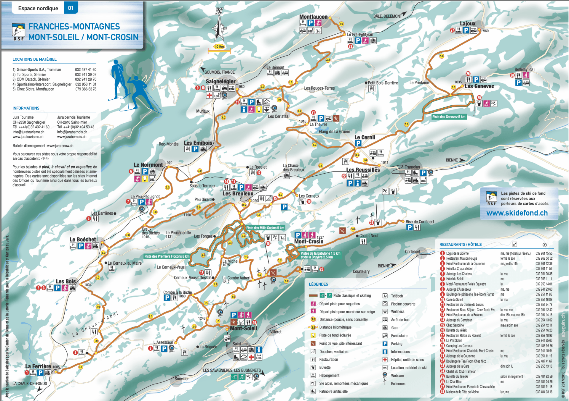
- Mont-Soleil / Mont-Crosin
Cross Country Ski Races
The historic La Transjurassienne or Transju’, starts on the original route: 68 kilometres between Lamoura (Jura) and Mouthe (Doubs) and is in the Worldloppet series of races. Races comprise:
- Transju' Experience - 20K Classic (no ranking)
- La Trans 25 - 25K Classic
- La Transju' Classic - 56K Classic
- Transju' Experience - 20K Free Technique (no ranking)
- La Trans 25 - 25K Free Technique
- La Transju' Marathon - 48K Free Technique
- La Transju' - 68K Free Technique
The Ultratrans consists of La Transju’Classic on Saturday (56 km) and La Transju’ on Sunday (68 km)
Tour companies who feature The Jura
Tourist Office | Resort Information | Twitter | Facebook
The Jura tourist website is - www.juratourisme.ch
The Jura-Bernois tourist website is - www.jurabernois.ch