Oslo, Norway
If you have a stop over in Oslo or want somewhere quick and easy to go for the weekend, here are a few ideas for a short skiing break. It is possible to leave the rest of your luggage at the Railway Station in the arrivals hall of Oslo Gardermoen airport, or with the baggage services at Oslo airport situated in parking garage.
There are over 2,600 km of prepared cross-country ski trails running deep into the forests of Oslo, 90 km of which are flood lit. The challenge is where to start skiing!
A report from Melanie March at MCCSC during her visit in February 2019 with additional researched information by Pauline
Transport around Oslo
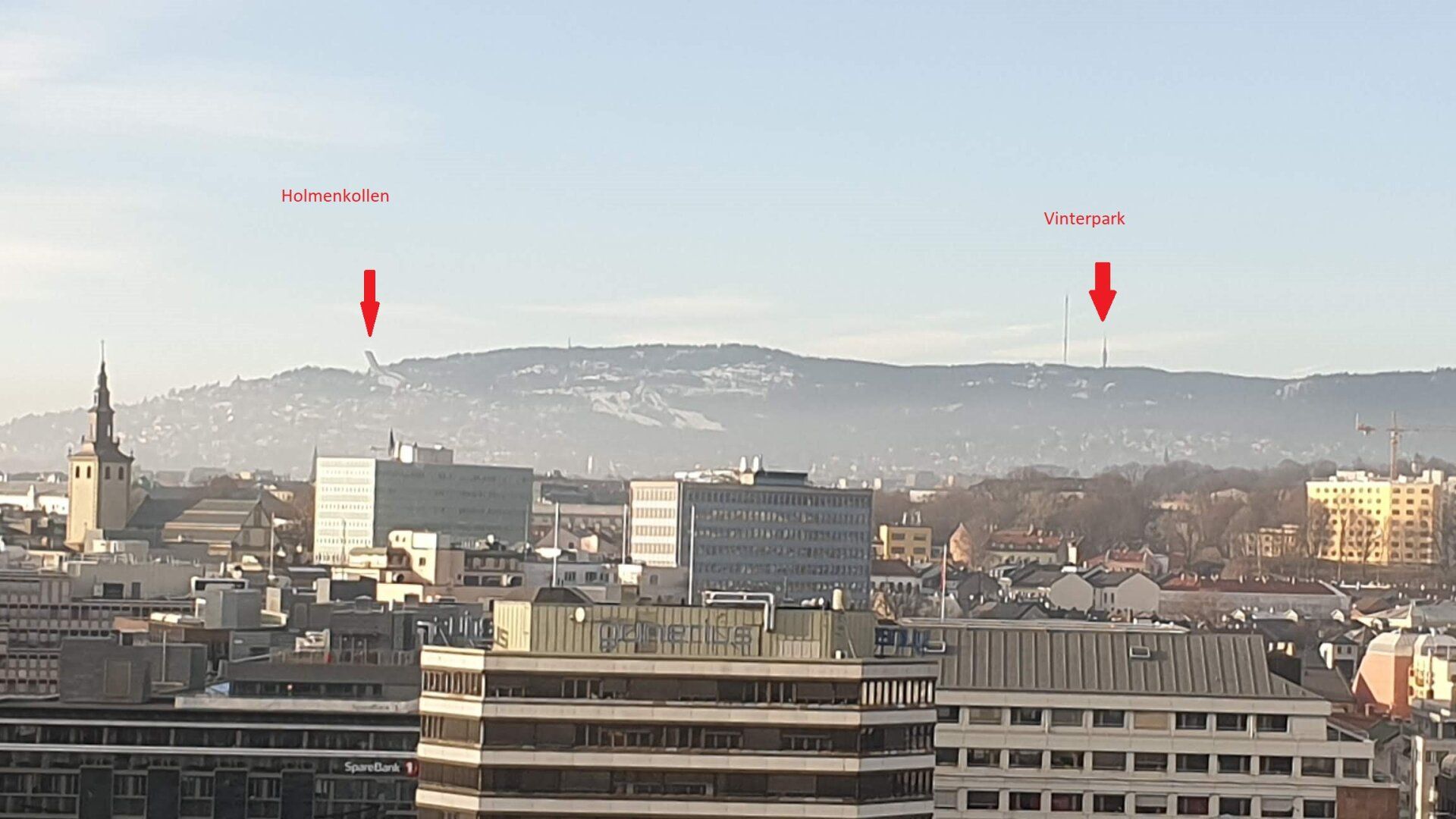
Vinterpark and Frognerseten are served by the Oslo Metro and are in Zone 1. You can buy one-trip tickets or a day pass from machines at the stations. If you plan on taking the metro 3 times in a day, the 24 hour pass is probably more sensible.
Cross Country Ski Tracks and Routes
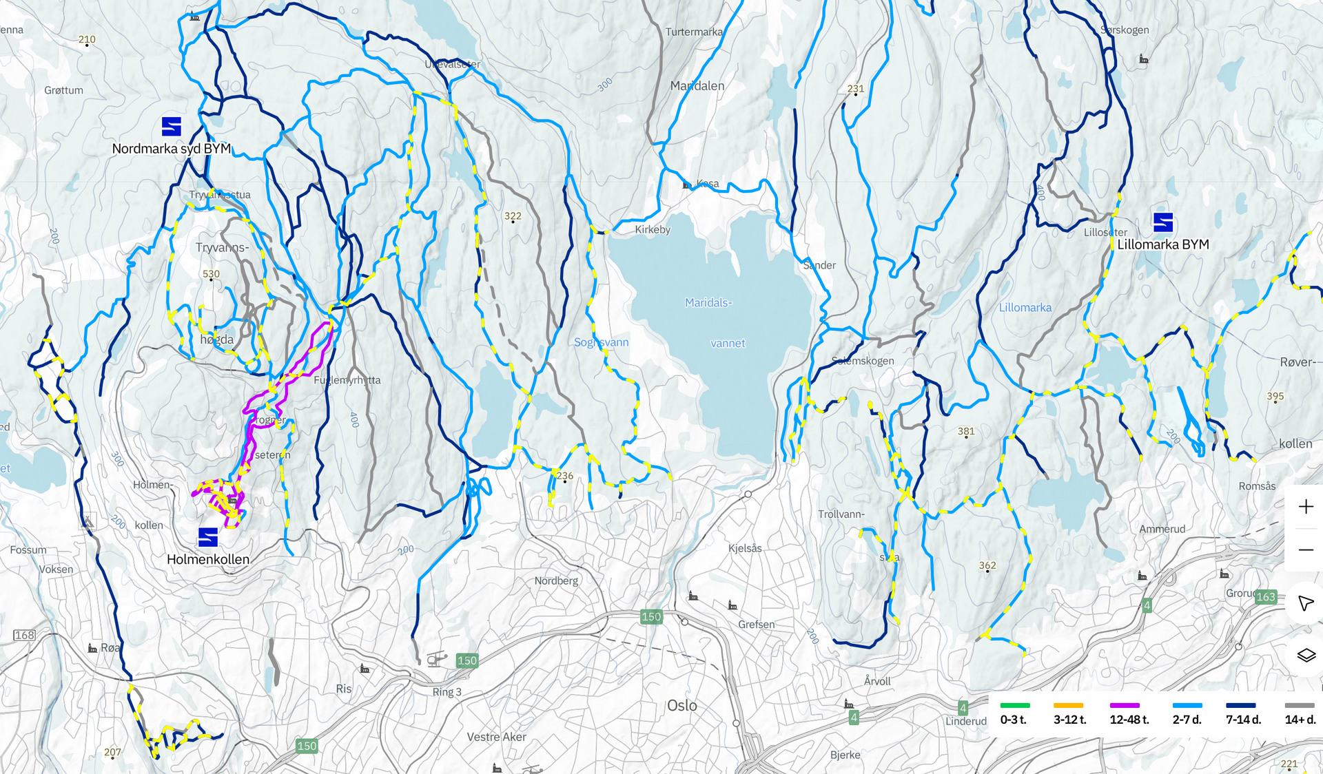
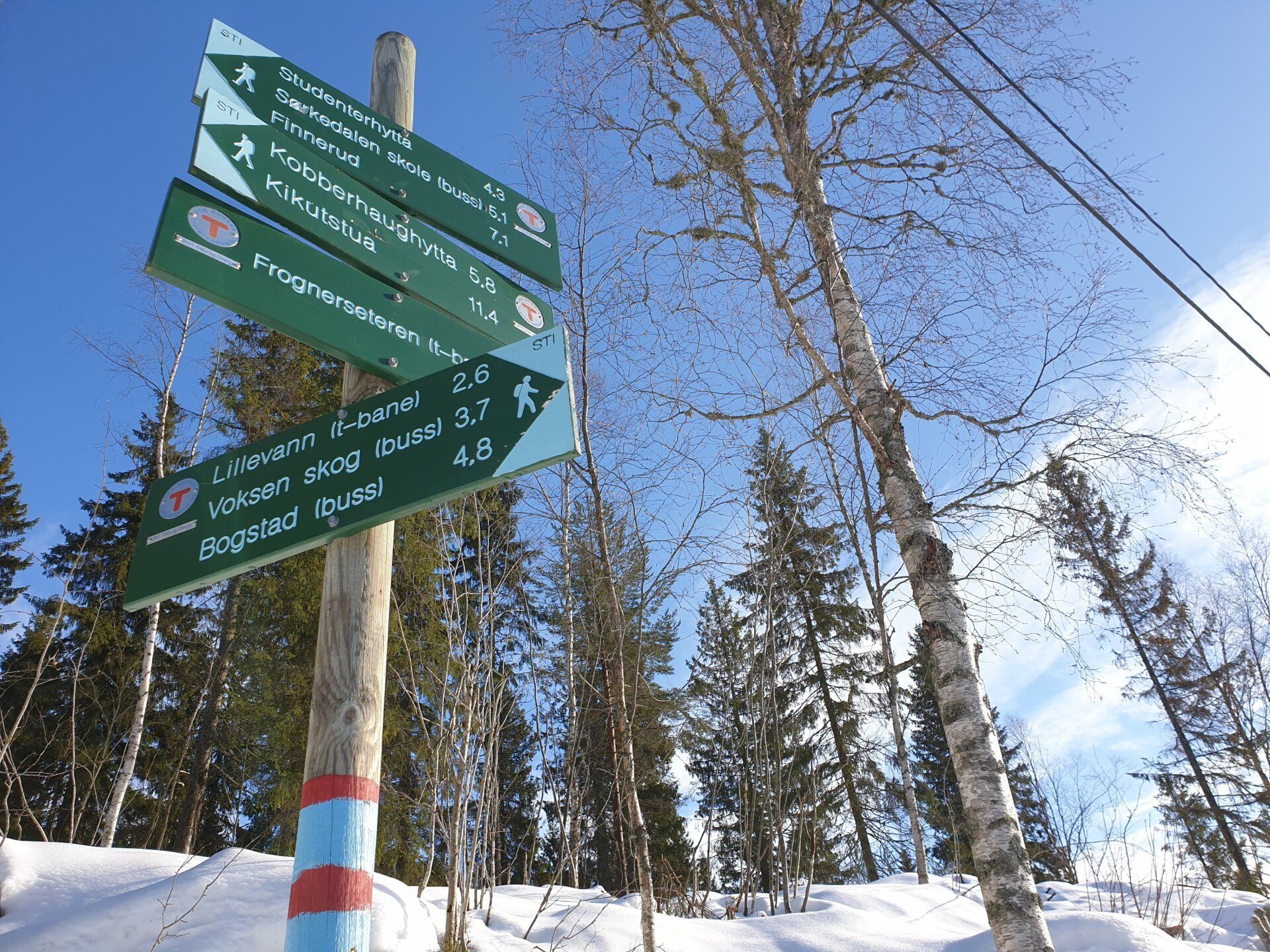
The Oslo trails are mapped by https://www.skiforeningen.no/ but the paper maps are not easy to buy in the city. The DNT store round the back of the cathedral should sell them, but it has very short opening hours on a Saturday. They appear to be very detailed and there are some signposts around on the trails that show the full map. Don’t expect your usual Blue/Red/Black conventions on the trails – you have to be able to read contour lines and understand the terrain.
There is an online route planning website and an Android app called iMarka which you can download. The main problems I found with the online route planning website was that you needed to be able to enter the name of the place exactly, and as a non-local, I didn’t understand the difference between the multiple places with Tryvann in the name (I assumed Skisenter was where I was picking up my skis, but it seems it was actually much further down the trail, causing me to change my endpoint to Skjennungstua instead of the planned Kobberhaugshytta). Also, you need to understand Norwegian to make sense of the trail status reports.
Ski trails have red marks on the signposts, and there are red bands on the trees. There are also hiking trails marked with blue on the signposts, and blue marks on the trees. Some of these ‘Blue’ trails become ski trails in winter, and are groomed.
The ski routes around Oslo are for the most part well marked and signposted, but it is still recommended to use a map, especially for long tours. Maps and more information about the sport cabins and outdoor activities are available at DNT Oslo & Omegn (located in Storgata 3 in the city centre). Maps are also generally available in sporting goods stores and in book stores.
Apart from the ski routes found below, there are descriptions of ski tracks from Mossemarka in the south to Gjøvikmarka in the north. The trails are prepared by the Ski Association and municipalities, trail teams and sports clubs. This is the link through google translate.
Some of these ski routes below are one way, so you’d need to consider this. They are in the Nordmarka map region if you buy one, or download it in the app.
The area of Holmenkollen provides access to a classic ski network covering approximately 2600 km and for skate approximately 1000 km. It also has around 90 kms of floodlit trails.
Some Oslo Cross Country Ski Routes
Cafés on Cross Country Ski Routes
There are 44 cabins around the Oslo cross country ski area some of which cater for overnight visitors and others for refreshments and home made pastries. You will find a full list of cabins here so that you can work out where they are for your chosen route.
Cross Country Ski Rental

I could only find one place to rent cross country skis in Oslo, and that was at Vinterpark Top Center. You can get there by taking Metro Line #1 towards Frognerseten and getting off at the Voksenkollen stop. It is either a 15 minute walk from here to the Ski Rental place or there is a 48 Ski bus that stops on the road on the ‘Towards Frognerseten' side of the tracks. If you want to walk the signage isn’t obvious, there is a path going uphill on the ‘Towards City’ side of the tracks that leads you to the road towards Vinterpark. The ski rental shop is mainly geared to downill skiers, but they rent out Salomon waxless skis, Leki Poles and surprisingly SNS boots!
You can obtain a 15% discount on ski rental with an Oslo pass, which also gives you transport and entry options.
Like all downhill focussed places it was tricky to find the start of the trail, I found a trail head at the opposite end of the car park, on the way out loop road. There was access onto the trail from behind Voksenkollen stop, and also from the large car park on the left hand side, opposite the Telenor mast.
There was also a slight negative of renting skis from this location, as you’re on the top of the hill, all routes are down (and some quite steep) so you will have to get back up the hill to return your skis.
Final Thoughts
If you have brought your own skis, you have a lot more choice of start and end points. The trails seemed to be groomed regularly, but heavily used on the day I went, so they were starting to break up a bit. If you were going to ski for multiple days I think you'd need to invest in a map to be able to select better routes.
Tourist Office | Resort Information | Twitter | Facebook
Visit Norway website - https://www.visitoslo.com/en/your-oslo/winter/cross-country-skiing/